Projects
Hi all !
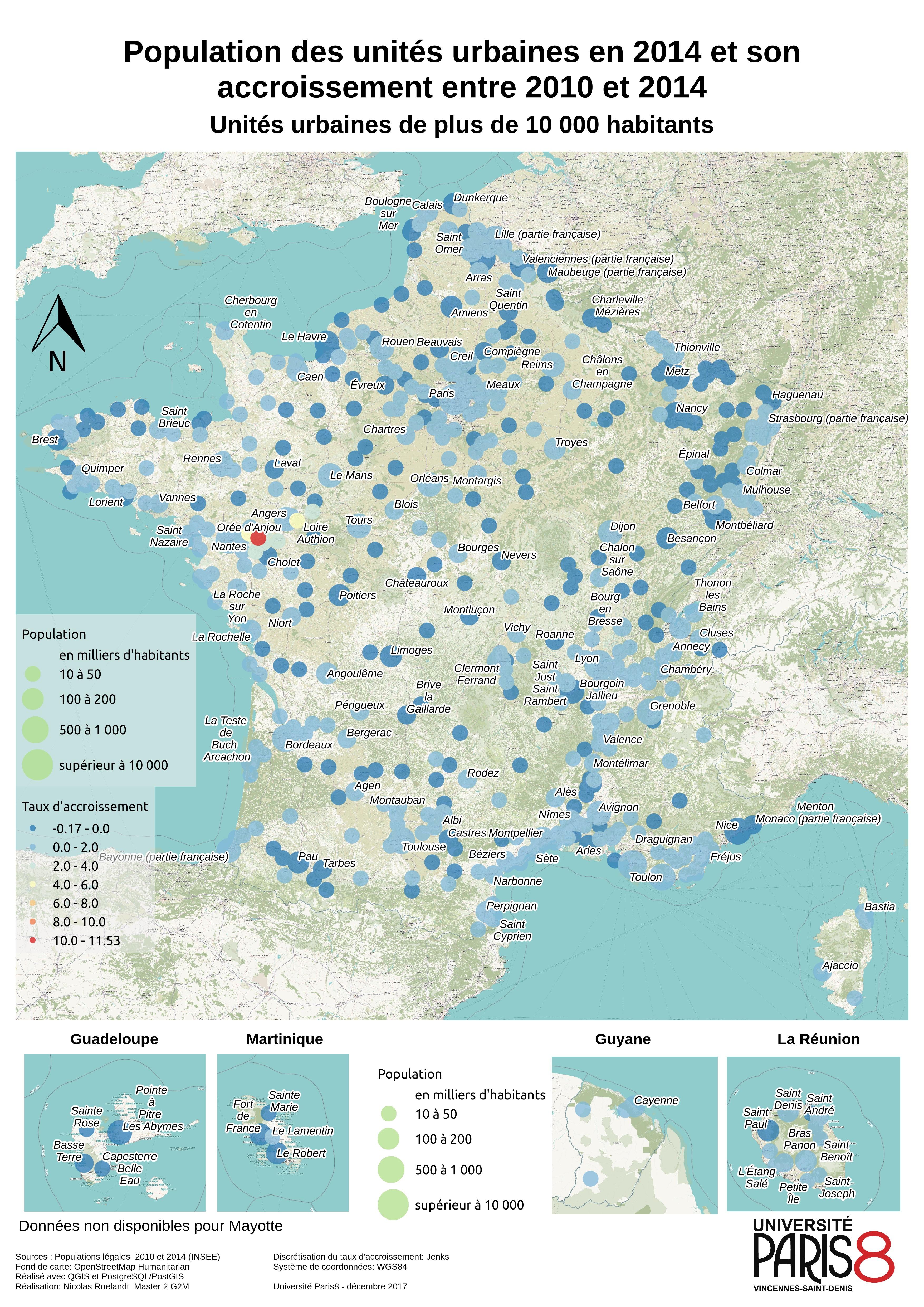
Sorry this map is in French but it was a school assessment, so… French it is.
Disclaimer: You might encounter a lot of french words and links to french webpages. You are warned.
The main goal was to work wih PostgreSQL and PostGIS on census data. Franc had around 36 000 communes which is the smallest administrative unit. Since it is too small to represent on a map, we worked on the Unités Urbaines1.
EDIT: I provided a quick update here, and it will be the main entrance of a post series regarding this subject, cheers ! https://roelandtn.frama.io/post/update-for-the-mexico-project/
Hello there ! It has been a long time since my last post. That’s because of a great project I’m working on for my Master degree. Explanations can be messy, we are at an early stage, just collecting data and try to select the most useful ones.
I’m currently working on a small part of a project for my new compagny involving VRT, Geoserver and Tomcat on a CentOS VM.
Easy, you should say, not to easy when it is your first time with all those components (except for GeoServer that I tried already).
So everything was new to me. Here is my notes on installing it and some configuration tips.
Sorry it is in French, but I didn’t had time to translate it yet.